- Kataloge
- Leica Geosystems
- LGS Monitoring Solutions BRO DE
LGS Monitoring Solutions BRO DE
1 /2Seiten

LGS Monitoring Solutions BRO DE
1 /2Seiten
Katalogauszüge

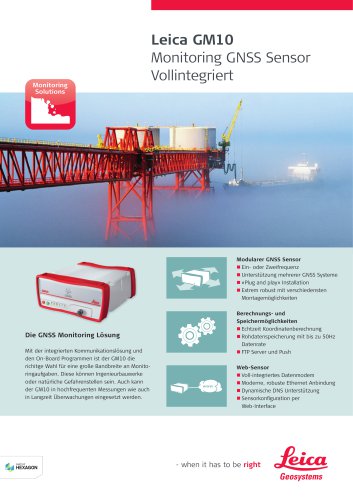
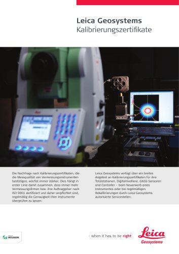
Nahtlos in die Software integriert Unsere ausgeklügelten Überwachungslösungen bieten eine Kombination aus zahlreichen geodätischen, geotechnischen und Umgebungssensoren mit einer vollständig an den Benutzer anpassbaren Software. Egal, ob Sie kurz- oder langfristige, einfache oder komplexe Projekte durchführen: Sie können sich sicher sein, dass Sie mit Leica Geosystems stets die besten Lösungen für Ihre Projekte finden. Leica Geosystems – when it has to be right Seit fast 200 Jahren revolutioniert Leica Geosystems, ein Unternehmen von Hexagon, die Welt der Vermessung mit seinen umfassenden Lösungen für Profis überall. Das Unternehmen ist bekannt für seine Premiumprodukte und die Entwicklung innovativer Lösungen zur Erfassung, Analyse und Präsentation räumlicher Informationen. Deshalb vertrauen Fachleute aus vielen Branchen wie Vermessung und GIS, Bau und Maschinensteuerung, Produktion, Luft- und Raumfahrt und öffentliche Sicherheit auf Leica Geosystems. Mit präzisen Instrumenten, moderner Software, erstklassiger Unterstützung durch den Service und Support sowie umfangreichen Dienstleistungen schaffen Kunden von Leica Geosystems täglich Mehrwert beim Gestalten der Zukunft unserer Welt. Entscheiden Sie sich für die weltbekannten Totalstationen und MultiStations von Leica Geosystems und erzielen Sie genaue und zuverlässige Überwachungsergebnisse in allen Situationen mit Bildinformation. Monitoring Solutions Unsere Empfänger und Smartantennen verfügen über die neueste GNSS-Technologie; Ihr Überwachungsbedarf wird somit übererfüllt. Copyright Leica Geosystems AG, 9435 Heerbrugg, Schweiz. Alle Rechte vorbehalten. Gedruckt in der Schweiz – 2018. Leica Geosystems ist Teil von Hexagon. 879244de - 04.22 Kompakte Plug-and-Play-Lösungen sorgen für die Internetanbindung im Feld und mehr Mobilität für Sensoren und externe Instrumente. Hexagon ist ein weltweit führender Anbieter digitaler Lösungen, durch die Autonomous Connected Ecosystems (ACE) entstehen. Hexagon (Nasdaq Stockholm: HEXA B) hat rund 20.000 Mitarbeiter in 50 Ländern und einen Nettoumsatz von rund 3,5 Mrd Euro. Die nahtlos integrierten Lösungen von Leica Geosystems Monitoring und IDS GeoRadar kommen Nutzern mit zusätzlichen ergänzenden Funktionen zugute. Leica Nova TM60 Data sheet Leica GM30 Ready for today and tomorrow Monitoring Solutions Monitoring Solutions Leica M-Com Plug & Play solutions for monitoring communication to react to complex demands of any project – be it continuous or periodic. The decision is easy: maximum safety, minimum risk, half-second at a time. n Permanent monitoring (24/7): remote operation, continuous monitoring, real-time measurement data, robust against various environmental conditions. monitoring app, connectivity to cloud services. n Buildings and structures: monitoring of buildings, skyscrapers, industrial and sports facilities, offshore and underground structures. bridges, roads & highways, airports, ports & canals. n Environmental monitoring: monitoring of landslides, rock falls, subsidence. n Energy infrastructure: monitoring of dams, oil & gas, nuclear facilities, pipelines power plants. n Mining: monitoring of slope stability, high walls and quarries. Monitoring professionals worldwide require timely position information of critical structures. Fast, accurate and reliable measurements are the basis for correct decisions. With 555 channels and a high-end GNSS processing platform, the Leica GM30 is the right choice. Future-proof and intelligent, this instrument delivers the highest quality results round the clock. QZSS, SBAS n Multi-frequency, code and phase observations n Powerful Leica SmartTrack+ technology Leica M-Com Leica GeoMoS Now! Leica CrossCheck Als Spitzenprodukte bieten die zweiachsigen, hochpräzisen Neigungssensoren von Leica Geosystems eine Auflösung von 0,001 mrad und können sowohl in Einzel- als auch in Netzwerkanwendungen genutzt werden. Make fast and informed decisions based on real-time data One simple, customised setup delivers automatic data analysis and distribution Specify user access and authorisation levels Store data securely, either locally or in the Cloud Seamlessly integrates with existing Leica GeoMoS projects HIGH-END GNSS TECHNOLOGY n Impressive 555 channels available, 50 Hz data rate, up to 20 parallel data streams n Multi-constellation: GPS, GLONASS, Galileo, BeiDou, NavIC, Gain complete access to your monitoring data with any web-based device Analyse data using comprehensive tabular view Inspect graphs, images, maps, tables and status reports, anytime, anywhere ALL-IN-ONE GNSS MONITORING RECEIVER n Full feature onboard software n Integrated communication solution (Ethernet, mobile Internet) n Ruggedised dedicated monitoring receiver (IP67) n Low energy consumption n Campaign monitoring (periodical): flexible instrument setup, automated measurements, Leica Captivate field software, dedicated n Transportation infrastructure: monitoring of tunnels, railway, Leica GeoMoS Now! Customise, connect and stay in control Leica GeoMoS Now! Review and share real-time monitoring data via a secure, customised website. LEICA NOVA TM60 MONITORING STATION: MONITOR IT. Leica Geosystems’ new monitoring solution comes with a strong promise: real-time information and reports you can always rely on, helping you make informed decisions in time and on time. Be it settling, flexing, shifting, sliding or any other change of state – you will have it under control 24 hours a day, seven days a week. The robust, precise and enduring TM60 comes with the world’s longest ATRplus range, half-second automatic aiming accuracy, advanced imaging and the longest continuous operation. Combined with the Leica GeoMoS monitoring solution, you will be able Monitoring Solutions Dank automatisierter Funktionen und minimierter Fehler lassen sich anspruchsvolle Nivellierarbeiten leichter und in kürzerer Zeit erledigen. Weitere Sensoren Leica Geosystems AG Dehnungsmesser Standortspezifischer Neigungssensor
Katalog auf Seite 1 öffnenAlle Kataloge und technischen Broschüren von Leica Geosystems
 Leica Captivate
2 Seiten
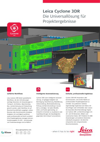 Leica Cyclone 3DR Data Sheet
2 Seiten
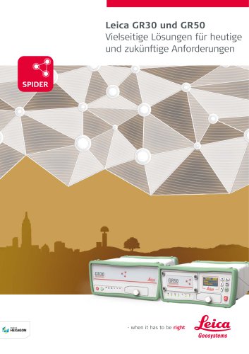 Leica GR30 / GR50 Brochure
4 Seiten
 Leica GR30 / GR50 Data Sheet
2 Seiten
 Leica LOC8 DS DE
2 Seiten
 Leica Rugby CLA-ctive & CLH
2 Seiten
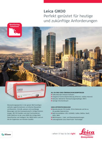 Leica GM30 FLY de
2 Seiten
 Leica GM30 DS de
2 Seiten
 Leica RTC360 LT Data Sheet
2 Seiten
 Leica AP20 AutoPole Datasheet
2 Seiten
 Leica Flexline TS10 DS DE
2 Seiten
 Leica Flexline TS03/TS07 DS DE
2 Seiten
 Leica Flexline Series DS DE
2 Seiten
 ScanCrete Solution Flyer
2 Seiten
 Leica Disto & Leica Lino
32 Seiten
 Leica iCON PA10 DS
4 Seiten
 Leica PowerBlade Flyer
2 Seiten
 Leica MCH100 Flyer
2 Seiten
 Leica iCON grade Brochure
8 Seiten
 Pegasus Backpack BRO
6 Seiten
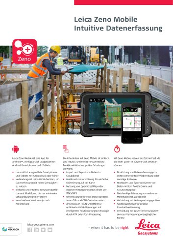 Leica Zeno Mobile Data Sheet
2 Seiten
 Leica Zeno Connect Flyer
2 Seiten
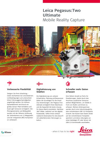
 Pegasus Two Ultimate BRO
4 Seiten
 Pegasus Two Ultimate DS
2 Seiten
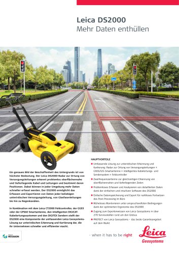
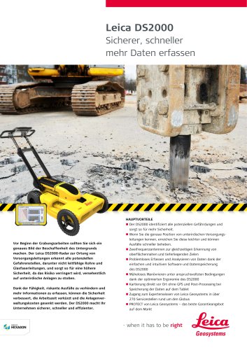 Leica DS2000 starter kit FLY
2 Seiten
 Leica DS2000 surveyors kit FLY
2 Seiten
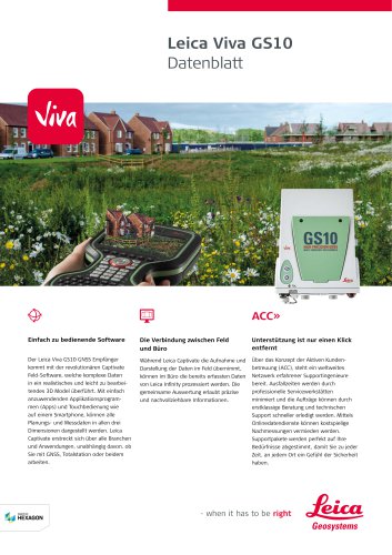 Leica Viva GS10 Data Sheet
2 Seiten
 Leica Piper Series
2 Seiten
 Leica BLK2GO Spec Sheet
2 Seiten
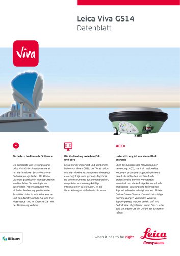 Leica Viva GS14 Data Sheet
2 Seiten
 Active Customer Care Brochure
8 Seiten
 Leica iCON foremen
2 Seiten
 Leica iCON gps 80 Contractor
6 Seiten
 Leica iCON gps 80 OEM
6 Seiten
 Leica iCON build
4 Seiten
 Leica iCON site Brochure
4 Seiten
 Leica GS07 DS DE
2 Seiten
 Leica GS18 DS DE
2 Seiten
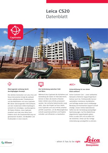 Leica CS20 DS DE
2 Seiten
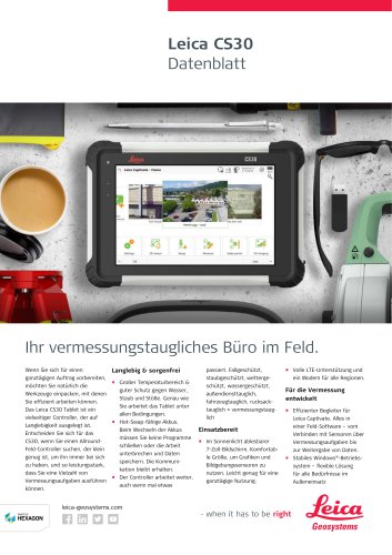 Leica CS30 DS DE
2 Seiten
 Leica CS35 DS DE
2 Seiten
 Leica Infinity Data Sheet
2 Seiten
 Leica Viva GS16 Data Sheet
2 Seiten
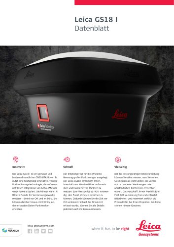 Leica GS18 I data sheet
2 Seiten
 Leica TS16 DS
2 Seiten
 Leica TS13 DS DE
2 Seiten
 Leica Nova TS60 DS DE
2 Seiten
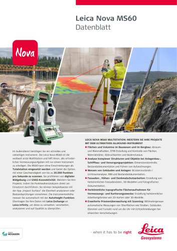 Leica Nova MS60 DS DE
2 Seiten
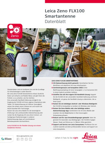 Leica Zeno FLX100 Smart Antenna
2 Seiten
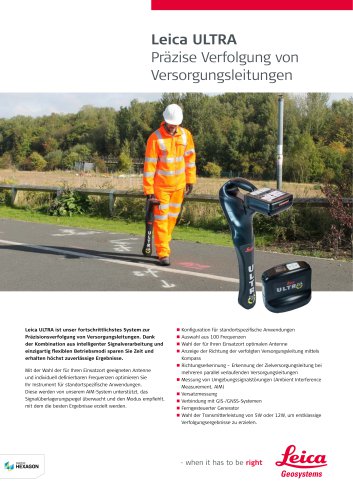 Leica ULTRA DS
2 Seiten
 Leica ULTRA BRO
4 Seiten
 LGS Detection Solutions A5 BRO
4 Seiten
 Leica ScanStation P50 Data Sheet
2 Seiten
 Leica TruView Cloud Data Sheet
2 Seiten
 Leica TruView Cloud Flyer
2 Seiten
 Leica Rugby 600 Series
8 Seiten
 Leica Cyclone REGISTER 360 Flyer
2 Seiten
 Leica Cyclone Cloud Flyer
2 Seiten
 Leica Cyclone SURVEY Data Sheet
2 Seiten
 Leica Cyclone MODEL Data Sheet
2 Seiten
 Leica iCON gps 60
4 Seiten
 Leica iCON gps 70 Series
4 Seiten
 Leica M-Com Brochure
4 Seiten
 Leica GS18 T GNSS RTK Rover
4 Seiten
 Leica ConX Flyer
2 Seiten
 Leica Active Assist Flyer
2 Seiten
 Machine Control Solutions Brochure
48 Seiten
 Leica iCON CC80 Flyer
2 Seiten
 Leica GeoMoS Now! Survey Edition
2 Seiten
 Leica iCON roller Flyer
2 Seiten
 Leica PowerDigger Lite Flyer
2 Seiten
 Leica LS Digital Levels
4 Seiten
 Leica AR10
2 Seiten
 Leica GM10
2 Seiten
 Leica AR25
2 Seiten
 Leica GeoMoS Now
2 Seiten
 Leica AR20 Flyer
2 Seiten
 Leica Nova TS60
4 Seiten
 Leica iCON grade iGG4
4 Seiten
 Leica iCON telematics
2 Seiten
 Leica Nova TM50
4 Seiten
 Leica TM6100A
6 Seiten
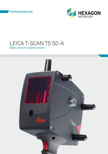 Leica T-Scan TS50A brochure
4 Seiten
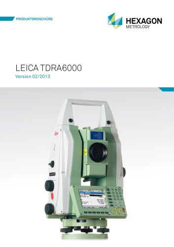 Leica TDRA6000
8 Seiten
 Leica Geo Office
3 Seiten
 Leica Viva
5 Seiten
 Leica SmartWorx Viva
3 Seiten
 PROTECT by Leica Geosystems
8 Seiten
 Leica Digicat xf-Series
12 Seiten
 Leica NA2 / NAK2
8 Seiten
 Leica Pegasus TRK100
4 Seiten
 Leica Pegasus TRK500/700 Neo BRO
9 Seiten
 Pegasus Manager BRO
4 Seiten
 Pegasus Swift DS
2 Seiten
 Pegasus Swift BRO
6 Seiten
 Leica FlexLine TS07
1 Seite
 Detection Campus BRO
4 Seiten
 Leica Zeno Field & Office Flyer
2 Seiten
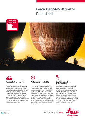 Leica GeoMoS Monitor Data Sheet
2 Seiten
 Leica GeoMoS Brochure
3 Seiten
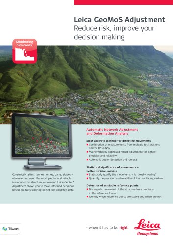 Leica GeoMoS Adjustment
2 Seiten
 Leica VADASE
2 Seiten
 AR25 Choke Ring Antenna
2 Seiten
 Leica Digicat i-Series
8 Seiten
 Leica Absolute Tracker AT402
16 Seiten
 Leica 3D Disto
22 Seiten


Archivierte Kataloge
 Leica Viva GS25 Data Sheet
2 Seiten
 Leica Zeno GIS
3 Seiten
 Leica Exchange Flyer
2 Seiten
 Leica Viva GS15 Data Sheet
2 Seiten
 Leica Viva GS15 Brochure
4 Seiten
 Leica Viva GS08plus Data Sheet
2 Seiten
 Leica Viva GS10 & GS25 Brochure
4 Seiten
 Leica Nova MS60 Brochure
4 Seiten
 Leica Viva TS16 Brochure
4 Seiten
 Leica Viva GS16 Brochure
4 Seiten
 Leica iCON CC66
2 Seiten
 Leica iCON build Construction
2 Seiten
 Leica iCON builder 60
4 Seiten
 Leica iCONtrol
12 Seiten
 Leica iCON robot 60
4 Seiten
 Leica iCON robot 50
2 Seiten
 Leica Infinity Brochure
4 Seiten
 Leica FlexLine TS06plus Brochure
6 Seiten
 Leica FlexLine TS09plus Brochure
6 Seiten
 Leica FlexLine TS02 plus
2 Seiten
 Leica Zeno 20 Brochure
8 Seiten
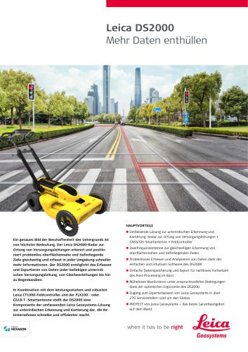
 Leica DS2000 Starter Kit Flyer
2 Seiten
 Leica DS2000 Surveyor Kit Flyer
2 Seiten
 Leica-Ortungslösungen
4 Seiten
 Construction Catalogue
84 Seiten
 Leica Cyclone & DotProduct Flyer
2 Seiten
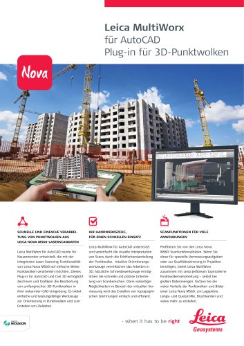 Leica MultiWorx Data Sheet
2 Seiten
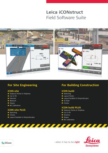 Leica iCONstruct Software
2 Seiten
 Leica FlexField plus Brochure
4 Seiten
 Leica DX Manager Flyer
2 Seiten
 Leica Detection Campus
2 Seiten
 Leica ULTRA
4 Seiten


- Digitaler Imager
- Automatisierungssoftware
- Management-Software
- Prozess-Software
- Windows-Software
- Echtzeit-Software
- Software für Architektur
- Cloud-Softwarelösung
- Steuerungssoftware
- Tablet mit Touchscreen
- Drahtloser Tablet
- Projektentwicklungs-Softwarelösung
- Gehärteter Tablet
- Überwachungssoftware
- 3D-Software
- Messsoftware
- Schnittstellen-Software
- WiFi-Tablet
- Visualisierungs-Softwarelösung
- Qualitätssoftware